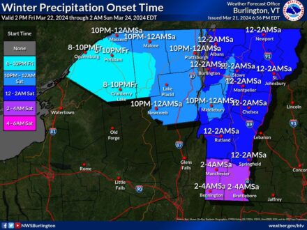
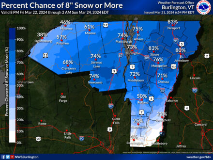
Thursday 9 PM Weather Update from the National Weather Service
 [Mar 21 PM Update] directly from the US National Weather Service Burlington VT: “Snow ratios remain in question as well, though in general, we should see >10:1 on the front and back ends of the storm, with 5-10:1 during the bulk of it during the daylight hours on Saturday. Central and southern Vermont, where mixed precipitation and warmer surface temperatures are forecast, is expected to see the greatest chance of impacts to the electrical grid, with scattered power outages likely due to heavy snow and ice-laden tree limbs. To the north, where the precipitation stays all snow and generally around 10:1 across the storm, snow amounts of 8-12″ appear likely, with the higher elevations above 2500 feet potentially up to 18″ from Mt. Ellen to Mt. Mansfield to Jay Peak.”
Posted: March 21st, 2024 under Northern NY News, Regional NY-VT News, Weather News/History.
